
Isn’t it fascinating how maps can teleport us back in time? They’re like time machines made of paper and ink, and with them, we can journey to distant pasts and forgotten tales. The first crusade maps are a prime example. Understanding these maps is akin to opening a vintage diary, one filled with quests, heroes, and ancient landscapes.
Have you ever thought about what drove thousands of knights and pilgrims from the heart of Europe to the distant walls of Jerusalem? How did they decide which paths to follow? Well, let’s embark on this journey together!
The Genesis of the First Crusade
The Call for Holy War: A Brief Background
Picture this: The late 11th century, Europe was buzzing with stories of the Holy Land under threat. It’s like someone ignited a spark in a tinderbox of devotion, and suddenly, Europe was ablaze with religious fervor. Pope Urban II, seeing an opportunity and a duty, stood in Clermont, France, in 1095 and proclaimed a call to arms. Ever imagined being in that crowd, listening to him? His words, as recounted by attendees, were about reclaiming the Holy Land from its captors.
What followed was a surge of emotions. It’s a bit like when your favorite sports team is playing the most crucial match – you can’t just sit around; you need to cheer, support, and be a part of the action! Similarly, thousands felt compelled to wear the cross and march thousands of miles in the name of faith. But where to start? Enter the importance of first crusade maps.
Key Starting Points and Initial Routes
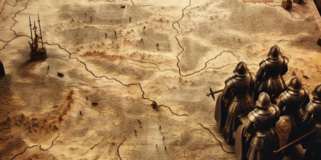
So, you’ve decided to embark on a life-changing pilgrimage. Now, imagine not having Google Maps or GPS! Sounds daunting, doesn’t it? That’s where our ancient cartographers come in. These map-making heroes are somewhat the unsung guides for our zealous pilgrims and knights.
The most prominent starting points? They’re a bit like the famous cities on our modern European backpacking routes – places such as Clermont, where the call was first made, and then Le Puy, Tours, and Vézelay. From these hubs, multiple routes branched out, converging and diverging like the roots of an ancient tree.
Now, let’s dive a bit deeper. You know how when you’re on a road trip, and there’s that one highway everyone uses? For the First Crusade, this was the path through the Byzantine Empire, specifically Constantinople (modern-day Istanbul). Imagine standing on the edge of this grand city, knowing it’s your gateway to the East. From there, the terrain gets trickier as they journeyed through Asia Minor, facing battles, making unlikely allies, and forging paths through treacherous landscapes.
But how did they avoid getting lost? Think about it like piecing together a jigsaw puzzle. They didn’t have a single, comprehensive map. Instead, they relied on a combination of local guides, earlier pilgrim accounts, and rudimentary first crusade maps. It’s a bit like piecing together Yelp reviews, friendly advice, and a sprinkle of intuition on a modern adventure.
And as these pilgrims and knights treaded along, their stories, their paths, and their memories started forming the intricate web of routes we now understand through these maps.
The tales hidden within first crusade maps aren’t just lines and waypoints; they’re narratives of faith, determination, and unyielding spirit. Isn’t it awe-inspiring how we can trace back the steps of individuals from centuries ago? Makes you wonder, a few hundred years from now, which of our journeys will people want to trace?
Maps, especially those as historical and rich as the first crusade maps, are more than mere tools. They are storytelling canvases that span time, cultures, and geographies. So, next time you look at a map, ancient or modern, take a moment to appreciate the tales it might be whispering.
Major Landmarks and Routes
As we continue our expedition through time, the first crusade maps lead us through major landmarks and routes that shaped the destiny of countless souls. Imagine these maps as parchment-bound storytellers, narrating tales of triumphs, hardships, and unexpected alliances.
The Byzantine Empire Connection
The Byzantine Empire, a bridge between East and West, emerges as a pivotal junction on the pilgrims’ path. Constantinople, the empire’s heart, stands as a crossroads of cultures and faiths. Can you visualize the crusaders arriving at this bustling metropolis, each step echoing with the footfalls of anticipation?
Much like arriving in a foreign city today, they must have marveled at the grandeur of Hagia Sophia, a testament to Byzantine engineering and architecture. This marvel wasn’t just a sight to behold; it was a compass pointing them toward their ultimate destination. The city’s influence on the first crusade maps was more than cartographic; it was an infusion of local knowledge, an understanding of the East’s complexities.
Through Asia Minor: Battles and Alliances
As the crusaders departed from Constantinople, the landscape transformed – lush meadows evolved into rugged terrains, and serene valleys gave way to arduous mountain passes. Battles marked the path as much as footsteps did. Can you picture the tumultuous clashes, each encounter shaping the narratives etched into the first crusade maps?
Among these challenges, unexpected alliances blossomed. The crusaders encountered the Seljuk Turks, sometimes as adversaries, other times as comrades against mutual foes. It’s like an epic tale where enemies unite against a greater evil. These encounters, woven into the threads of the first crusade maps, underscored the shared humanity even amidst conflict.
The Long March to Jerusalem: Significant Stops
Ah, the journey to Jerusalem – the culmination of faith and endeavor. The road was long, harsh, and unyielding, much like a marathon through history. The first crusade maps document key stops along this epic march, like Antioch, where the crusaders weathered the harshness of winter and the trials of a lengthy siege. Can you feel the desperation, the perseverance, as they clung to their purpose?
And then, the Holy City emerged on the horizon. Jerusalem – a beacon of hope and devotion. The first crusade maps vividly illustrate this final stretch, the culmination of countless steps and dreams. As the crusaders reached Jerusalem’s walls, the maps became their witnesses, recording the end of one chapter and the beginning of another – a chapter marked by conflict, triumph, and a fervent journey’s end.
The Siege of Jerusalem: A Cartographic Overview
The Surrounding Topography and its Role
Imagine standing on a hill overlooking Jerusalem, holding a first crusade map in hand. The terrain surrounding the city comes into focus – valleys, hills, and strategic positions. The topography wasn’t just a backdrop; it was a key player in the siege that followed. Can you envision the crusaders, using their maps to plan and strategize, knowing every inch of land could mean victory or defeat?
The topography offered advantages and challenges. Hills provided vantage points, while valleys concealed movement. The first crusade maps essentially became blueprints for maneuvers, guiding the crusaders in their bid to breach the city’s defenses. It’s like a grand game of chess, with each move calculated, each position crucial.
Troop Movements and Strategies Illustrated
The siege of Jerusalem was a symphony of troop movements, strategies, and sheer will. These intricacies are vividly portrayed on the first crusade maps, each line and annotation a testament to meticulous planning and courageous execution. Can you see the knights advancing, shields gleaming in the sun, as the maps guided their coordinated efforts?
From battering the city walls to outmaneuvering defenders, the first crusade maps tell a tale of tactical brilliance. The maps detail siege engines and formations, as if they were the architects of victory. As the city’s defenses crumbled, the maps served as the witnesses to a momentous event – the capture of Jerusalem.
Through the lens of the first crusade maps, we’ve ventured into a world of battles, alliances, and the unyielding human spirit. These maps aren’t just ink on parchment; they are the essence of human endeavor and the stories of those who sought to change history’s course.
So, next time you look at a map, remember the stories it holds, the struggles it witnessed, and the triumphs it narrates. These maps, whether ancient or modern, are windows into the human experience, painting a vivid picture of our journey through time.
Lesser-Known Paths: Divergent Routes and Their Tales
In our exploration of the first crusade maps, we’ve traversed the well-trodden routes and relived the pivotal moments. But what about the paths less traveled? These lesser-known routes hold their own tales of adventure and intrigue, awaiting their moment in the spotlight.
The Overlooked Detours: Stories from the Map’s Margins
Just as a book’s margins often hide annotations and musings, the margins of the first crusade maps harbor stories of detours and deviations. Imagine these detours as hidden treasures, waiting for us to uncover. These deviations from the norm might have been due to resource shortages, changing circumstances, or simply the thirst for new experiences.
Consider the alternate routes taken by some crusaders – like rivulets branching off a river, these paths diverged from the main current. These overlooked trails may not have been recorded as prominently, but they are no less important. The first crusade maps become our guide to these tales of courage and innovation, inviting us to retrace these forgotten steps.
Key Figures and Their Journeys
In the grand tapestry of the First Crusade, there were individuals whose journeys stood out, each a thread contributing to the larger narrative. The first crusade maps introduce us to these key figures – nobles, knights, and pilgrims whose names echoed through history. Can you picture these figures charting their own courses on the map, each path reflecting their unique motivations and destinies?
Imagine tracing the journey of Bohemond of Taranto, whose route meandered through treacherous terrains and diplomatic intricacies. Then there’s Anna Komnene, a Byzantine princess who documented the crusaders’ arrival with a mix of curiosity and skepticism. Their stories, etched in the margins of the first crusade maps, remind us that history isn’t just about events; it’s about the people who shape them.
The first crusade maps are like portals to a bygone era, where every path, no matter how well-trodden or less known, speaks of human courage, curiosity, and conviction. As we traverse the roads of history through these maps, we’re reminded that there’s more to discover than what’s on the surface.
So, next time you journey with a map, consider the roads less taken – the ones that weave stories of their own. In these divergent paths lie tales of bravery, individuality, and the beauty of exploration. Just like the adventurers of old, let’s continue uncovering the hidden stories etched in the folds of the maps.
Modern Reflections on Ancient Maps
As we come to the close of our journey through the first crusade maps, it’s time to turn our gaze from the past to the present. The intersection of ancient cartography and modern understanding offers a unique lens through which we can appreciate the complexities of the First Crusade.
The Art and Science of Crusader Cartography
Cartography, both an art and a science, played a crucial role in the First Crusade’s narrative. The first crusade maps weren’t merely utilitarian tools; they were works of art, each stroke of ink capturing the spirit of an era. Imagine the cartographers of old, hunched over their parchment, carefully plotting routes and landmarks. They were, in essence, crafting a visual time capsule.
But it’s not just about aesthetics. The first crusade maps were also a testament to the scientific knowledge of the time. Calculations of distances, estimations of terrain, and even the depiction of celestial bodies – all were part of the cartographer’s arsenal. These maps were an amalgamation of creative intuition and empirical data, a marriage of imagination and observation.
Comparing Contemporary and Historic Maps
Fast-forward to today, and we’re armed with technology that would have seemed like sorcery to those early mapmakers. With satellite imagery, digital mapping tools, and geospatial data, we can explore the crusaders’ routes in ways they couldn’t have dreamed. The contrast between contemporary and historic maps is both enlightening and humbling.
Consider overlaying a first crusade map onto a modern map. The ancient ink lines intersect with the pixels and lines of today’s technology. It’s like watching history dance with the present – an intricate choreography of tradition and innovation. This comparison offers us a deeper understanding of the terrain, the distances, and the challenges the crusaders faced.
Conclusion
As we bid adieu to the winding roads and distant lands of the First Crusade, we’re left with an indelible truth: first crusade maps are more than geographical records; they are conduits to stories of determination, faith, and the indomitable human spirit. The routes they outline are more than lines on paper; they are the paths of souls who embarked on a transformative journey.
With each step we’ve taken through this exploration, we’ve witnessed the power of maps – how they unite the past and present, how they reveal the complexity of historical events, and how they serve as a bridge between generations. In understanding the First Crusade through these maps, we understand not only the physical journey but also the emotions, the ambitions, and the dreams that propelled these crusaders forward.
So, the next time you unfold a map or launch a digital map app, remember the stories that maps tell – stories of adventure, connection, and the ceaseless quest for discovery. The first crusade maps remind us that history isn’t a static entity; it’s a dynamic narrative, and each map is a chapter waiting to be explored.